
Featured

Featured
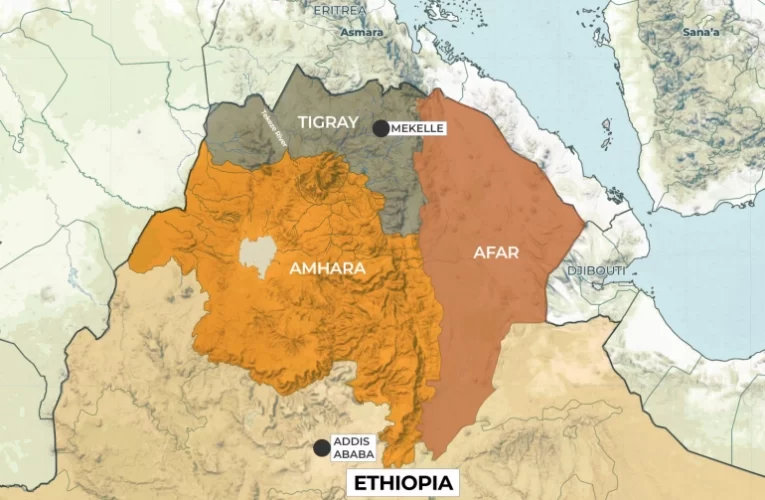
Ethiopia’s government and TPLF agree to end war
Ethiopia’s government and TPLF, not including all warring sides, have agreed to a permanent end to hostilities in a conflict believed to have killed hundreds of thousands. As many as 500,000 … Read More

Featured
Daily News Mashup 2022
Ethiopia: Government, Tigrayan forces agree to end a two-year war Aljazeera Ethiopia does not need another Lethal Northern War ኢትዮጵያ ሌላ ገዳይ የሰሜን ጦርነት አያስፈልጋትም 1.- Ethiopian Air Force Shots Down … Read More

Featured

Featured
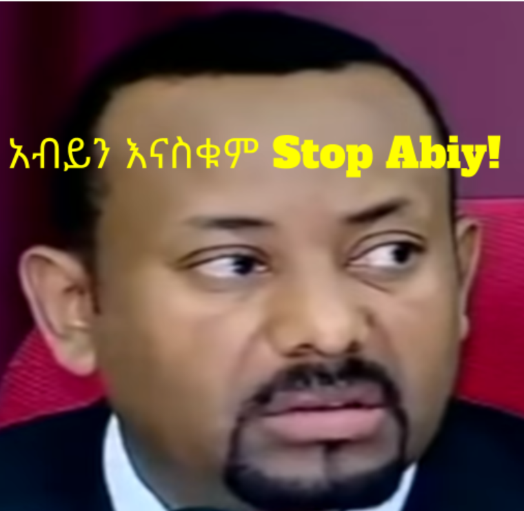
To Stop Ethiopian Bloodshed, Abiy must Step Down! የደም መፋሰስ እንዲቆም አብይ ይውረድ 26 Mar 2021-12
[3d-flip-book mode=”fullscreen” id=”12096″][/3d-flip-book]

Featured
Sudano-Egyptian “Scramble” for Ethiopian fertile land የኢትዮጵያ ቅርምት?
Sudano Ethiopian border dispute flares on the area known as al-Fashaga, where the north-west of Ethiopia’s meets Sudan’s Gedaref state. The exact boundary is never demarcated on the ground. However, … Read More

Featured
Ethiopian Tigray Civil War 7 possible Outcome Choices?የትግራይ ጦርነት 7ቱ የተወሰኑ የውጤት አማራጮች?
I.- Ethiopian Civil War 7 Outcome Choices – ጦርነት 7ቱ የውጤት አማራጮች 1.1- Tigray’s TPLF Limited Choices of war outcomes 1.- Topple Abiy and Issaias 2.- Surrender to Abiy and … Read More
Featured
A Civil war declared by Noble Laureate Abiy Ahmed in Ethiopia!
Ethiopia is in a state of civil war declared by the Nobel Peace Prized prime minister Abiy Ahmed, on Wednesday 4th of November 2020. Abiy also announced a state of … Read More
Featured
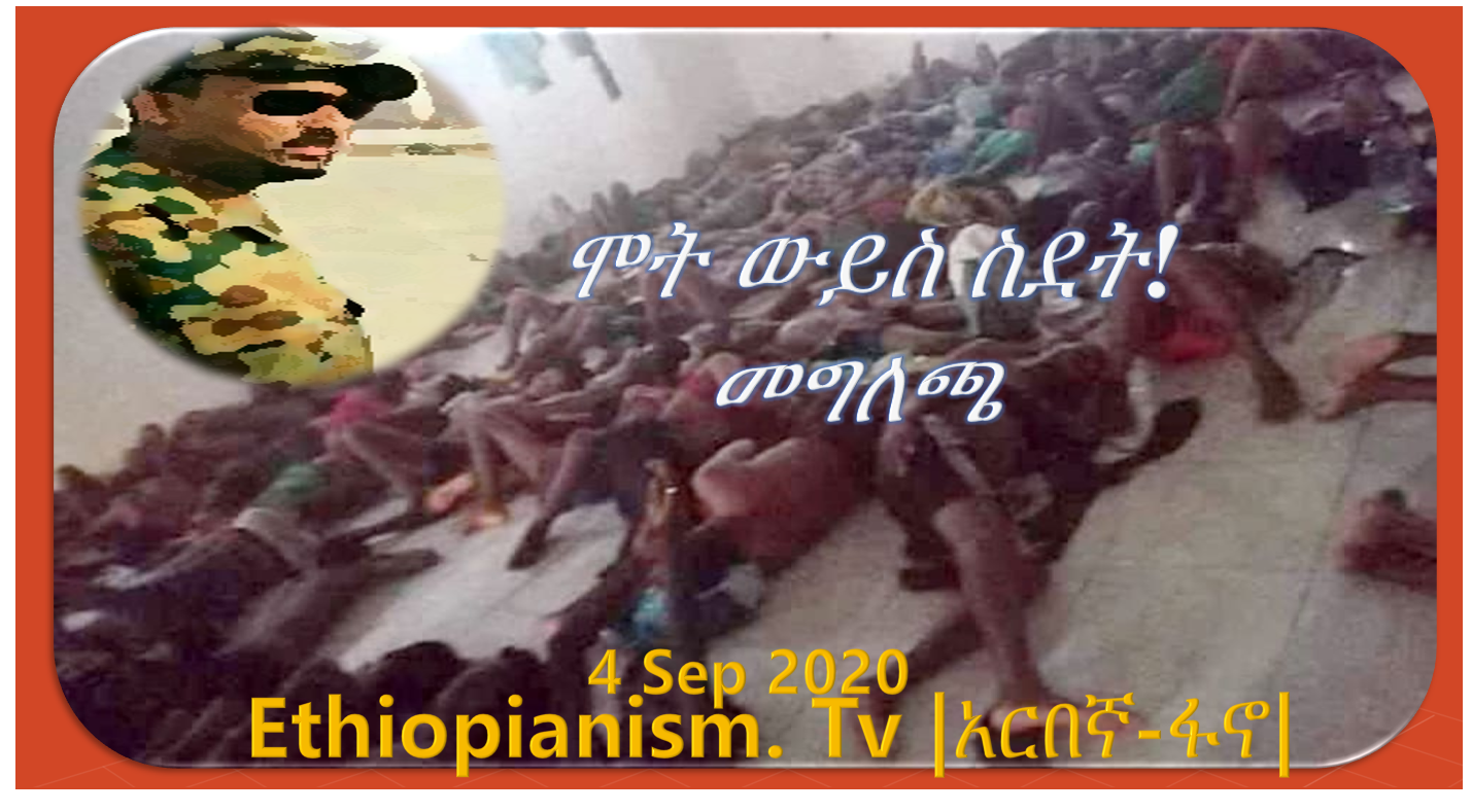
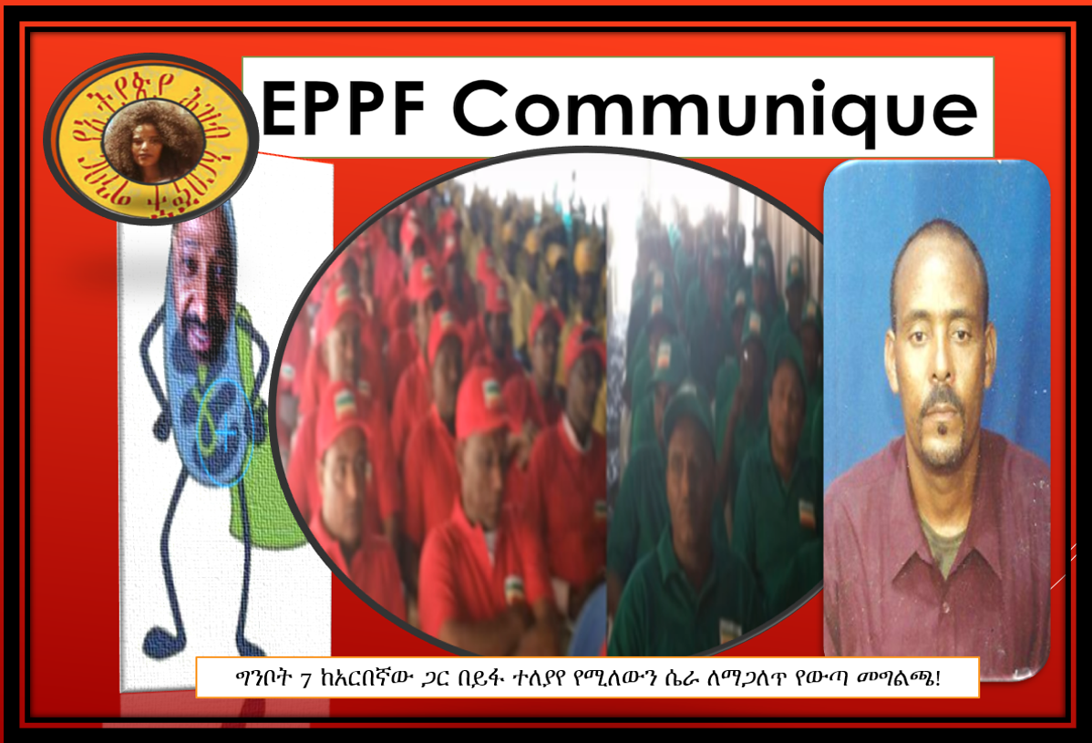
አርበኛ-ፋኖ| ኢትዮጵያኖች አረቢያ ስደት ሞት መግለጫ EPPF Communique statement on Ethiopians Abused in Arabia
የኢትዮጵያ ሕዝብ አርበኞች ግንባር (ኢህአግ) No. 2020/03 Sep 4, 2020 በመካከለኛው ምስራቅ ሳውዲ አረቢያና የመን በስደት ላይ በሚገኙ ዜጎቻችን ሕይወት ላይ እየደረሰ ያለው ችግር እና የመንግስት ቸልተኝነትን አስመልክቶ የተሰጠ መግለጫ … Read More
Featured
Arbegna Fano Communique on the arrest of member Meseret Kelmework!
The Ethiopian People’s Patriotic Front የኢትዮጵያ ሕዝብ አርበኞች ግንባር ye’ītiyop’iya ḥizibi āribenyochi ginibari July 10th, 2020 EPPF Communique statement on the arrest of our Arbegna Fano member Meseret Kelmework! No. … Read More

Featured
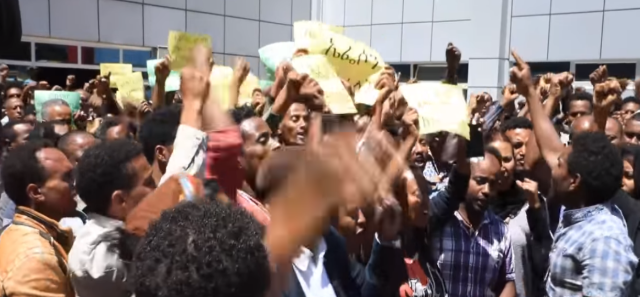
Since the coming to power Premier Abiy, repeated Targeted political killings brought persistence Chaos in Ethiopia!
Violent demonstrations engulfed Ethiopia following the murder of popular Oromo singer Haacaaluu Hundeessaa. He was shot dead by a targeted killer in Addis Ababa on Monday night, fuelling ethnic tensions … Read More
Featured
Tigray Police in Mekele kills in name of “coronavirus regulations”
Two police officers, one armed with a rifle fired and killed due to so-called flouted coronavirus regulations. During the incident, two other men were shot and wounded, it was reported. The … Read More
Featured

Featured

Featured
Ethiopia of PM Abiy Student abduction and female kidnapping are rampant!
Since the coming to power of PM Abiy Ahmed in April 2018, over 3.7M Ethiopians have been internally displaced and over 10 million Ethiopians are in famine according to … Read More
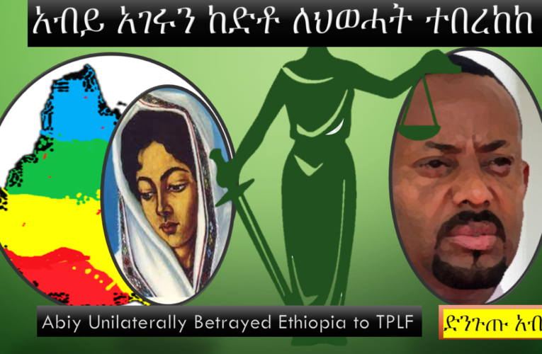
Abiy Unilaterally Betrayed Ethiopia To TPLF አብይ አገሩን ከድቶ በግሉ ለህወሓት ተበረከከ
Discussion Themes – የውይይት አርሥተ-ሃሳቦች 1.- Whose pressure forced Abiy to cede in all grounds to TPLF’s exigencies? አብይ በሁሉም ምክንያቶች የህወሓትን ፍላጎት እንዲያሟላ ያስገደደው የማን ግፊት ነው? 2.- Why … Read More
Ethiopia in tightrope with UN & US
U.N. Secretary-General Antonio Guterres called on the government of Ethiopia “to allow the urgent delivery of aid “without hindrance” and the “unrestricted movement of desperately needed fuel, cash, communications equipment … Read More
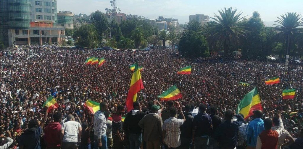
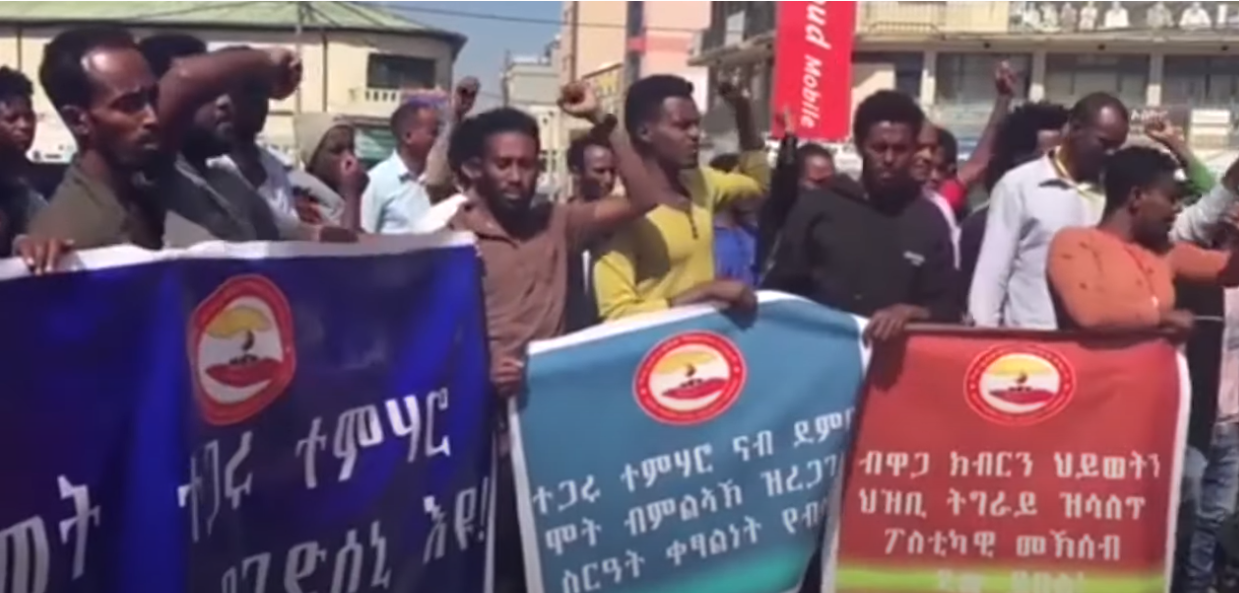
Amhara mass Protest against genocide in Ethiopia!
Mass Amharas are protesting all over Amhara regional state against massacre and forced displacement. It took a form of genocide since the coming to power of Abiy Ahmed in … Read More
Abiy a Dictator who won a Peace Laureate!
A year that Prime Minister Abiy Ahmed won the Nobel Peace Prize, his army ‘shot a man dead because the phone rang’ – Amnesty International. It testifies also how three … Read More
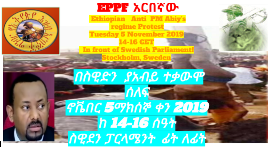
EPPF’s Second Open Letter To The Swedish Parliament
5th of November 2019 Dear Excellencies, Today, we are manifesting in front of your esteemed legislative Office in Stockholm. This is a noble act to call your attention for the … Read More
EPPF Communique November 1, 2019/03 Oromia Massacre Responsibilities!
ከኢትዮጵያ ህዝብ አርበኞች ግንባር የተሰጠ መግለጫ ቁጥር 2019 / 03 በኦሮሞ ባንቱስታን ለደተረገው ጭፍጨፋ የኢትዮጵያ ህዝብ አርበኞች ግንባር የወያኔ / ኢሃዴግ አቢይ መንግስት ስልጣን ከተቆናጠጠ ጀምሮ በታቀደና በተጠና መልኩ በተከታታይ … Read More

One-sided Peace Prize awarded to PM Abiy Ahmed for an inconclusive deal with Eritrea!
The Norwegian Peace Nobel Committee Chair Berit Reiss-Andersen on Friday after awarding Ethiopian Premier Abiy Ahmed confirmed that “peace agreement will help to bring about positive change for the … Read More
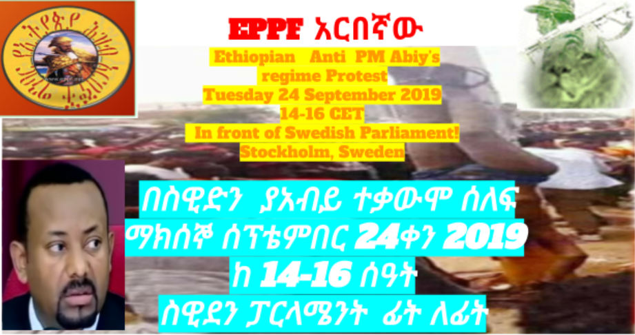
EPPF’s Open Letter to Members of Swedish Parliament on PM Abiy Ahmed of Ethiopia!
24th of September 2019 Dear Excellencies, We are calling your attention today by manifesting in front of your esteemed legislative Office in Stockholm in your beloved capital. Since the coming … Read More
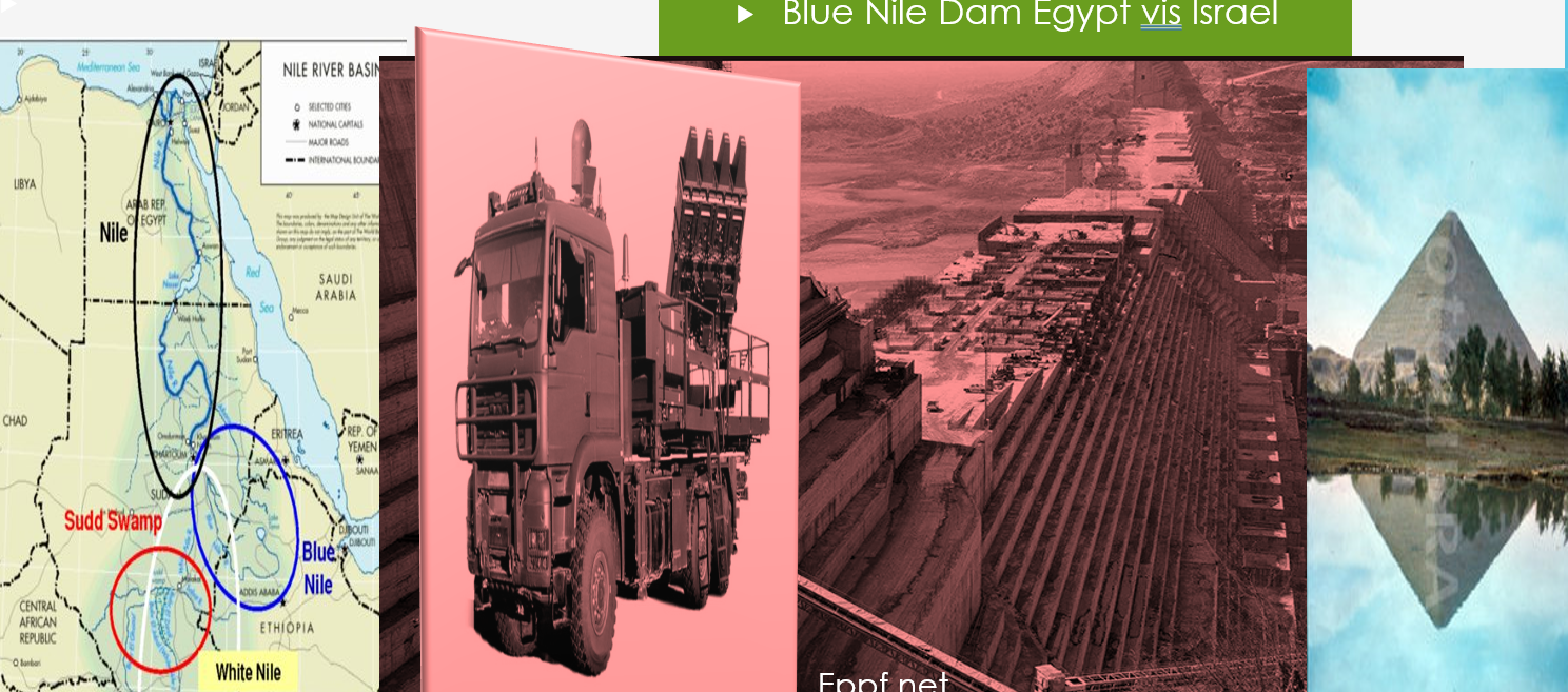
Egypt shows concern on Ethiopian Nile Dam to be secured by the Israeli defense system!!
Middle eastern analysts claimed three “Israeli firms installed” the Spyder-MR air defense system for Ethiopia, which can simultaneously fire two different types of missiles, to shield the Blue Nile mega-dam. … Read More
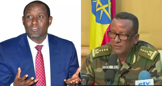
Ethiopia Abiy’s regime in disarray- generals killed regional leader shot
The chief of staff of the Ethiopian army, Gen Seare Mekand the regional governor, Ambachew Mekonnen, was killed along with another official has been shot dead, state media confirmed. The … Read More
Ethiopia to start rationing electricity due to mega-dam water level drops.
The drop in water levels behind the 1,870MW Gibe III dam on the Omo River, which began full operations in 2016, had caused a deficit of 476MW, more than a third … Read More
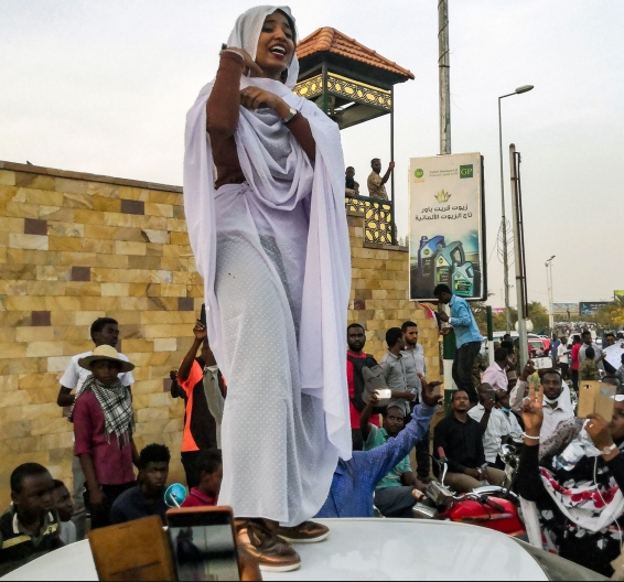
30 Years old brutal dictatorial regime ousted in Sudan!
Sudan has been engulfed by a revolution that was ignited by over 300 popular protests taking place across the country starting 19 of December 2018. The general uprising started in … Read More
Ethiopian Ethnic Federalism imploding in endless Crisis in 2019!
Since the coming of PM ABiy in Ethiopia April 2018 thousands killed, many more injured and over 3 million people displaced due to rising ethnic violence. Premier Abiy’s regime has … Read More
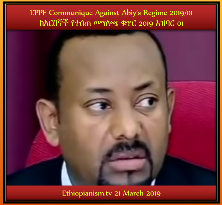
Ethiopia #EPPF Communique Against Abiy’s Regime in Ethiopia ከአርበኞች የተሰጠ መግለጫ 2019/01
—— የኢትዮጵያ ህዝብ አርበኞች ግንባር የወያኔ / ኢሃዴግ አቢይ መንግስት በታቀደና በተጠና መልኩ በመላ ሃገሪቱ በዜጎቻችን ህይወት ላይ እየተደረገ ያለውን በዘር ላይ ያነጣጠረ የዘር ማጥፋት እና መከኖሩበት ቀዬ የማፈናቀልን በጥብቅ … Read More
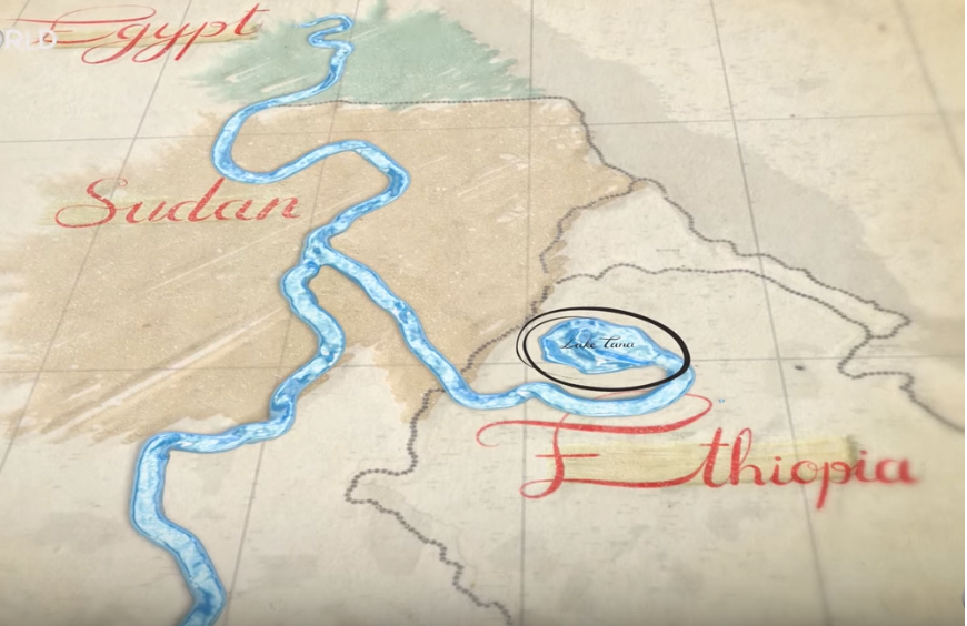
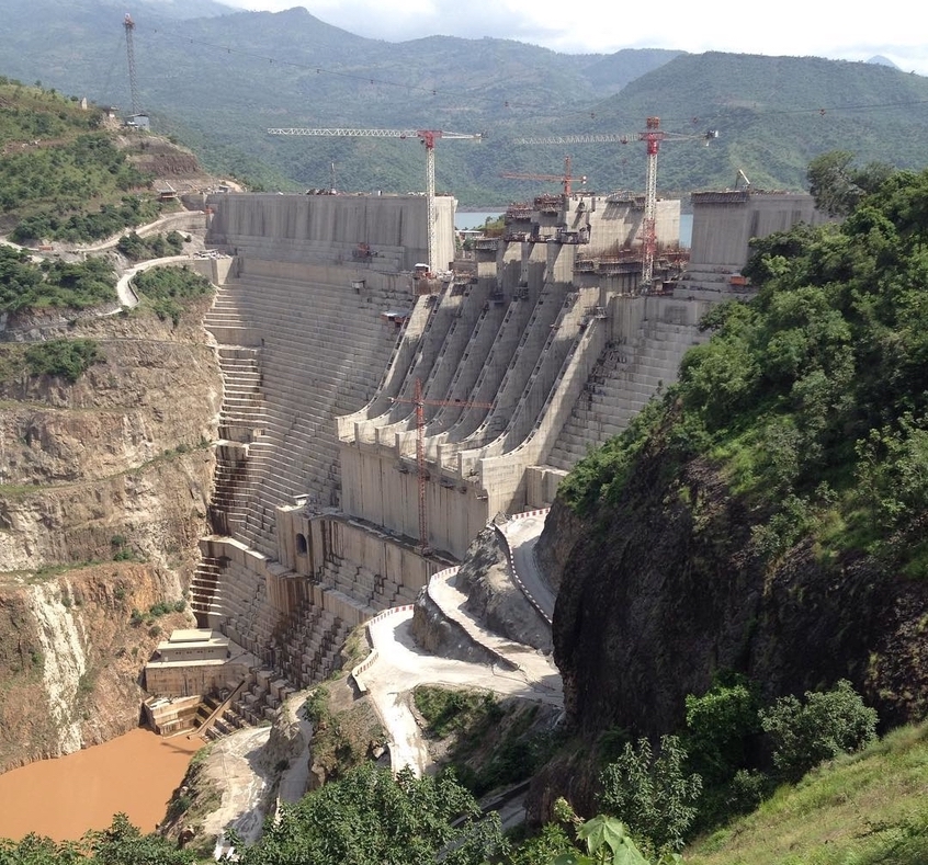
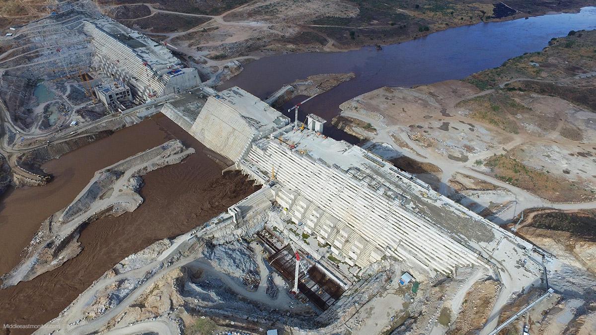
The Nile under treat by Ethiopian Mega Dam?
Ethiopia started building the GERD on the Blue Nile since May 2011. Downstream countries Egypt & Sudan voiced their concern as the dam could affect their water shares. Egypt’s 80 … Read More
Is the Nile under treat by Ethiopian Mega Dam?
— — —– Ethiopia started building the GERD on the Blue Nile in May 2011. Downstream countries Egypt & Sudan voiced their concern as the dam could affect their water … Read More

UN Security Council lifts sanctions against Eritrea with the demand of Ethiopia
The resolution approved by the U.N.’s most powerful body commended to lift sanctions against Eritrea following its thaw in relations with Ethiopia’s PM Abiy blind support. Ethiopia’s so-called “reformist” prime … Read More

Ethiopian PM Abiy revised his version claims “soldiers who marched on palace sought to ‘kill me’?
Hundreds protesting soldiers, some of them armed, went to see the prime minister – reportedly to demand a pay rise. The 42-year old leader doing push-ups with smiling men in … Read More

Liberate Ethiopian Political Prisoners in Sweden! Swedish immigration Authorities!
Ethiopia a Land of Impunity and mob Justice! Mr. Yilma Kiflu and Mr. Mesfin Agdew are now in prison in Sweden. They will be deported to Ethiopia a country they flee from … Read More
EPPF Communique separation of EPPF & Ginbot N° 2008/04 በኢትዮጽያ ህዝብ አርብኞች ግንባር የተሰጠ መግለጫ ቁጥር 2008 እዝባር 4 !
ግንቦት 7ና አርበኛው አንድንት ሴራ መግልጫ! ሰሞኑን በሚድያዎች እየተሰራጨ ያለው ግንቦት 7 ከአርበኛው ጋር በይፋ ተለያየ ተብሎ እየተነገረ ያለው የሻቢያና የውያኔን ሴራ ለማጋለጥ የውጣ መግልጫ! የኢትዮጵያ ህዝብ አርብኞች ግንባር ውያኔንና … Read More
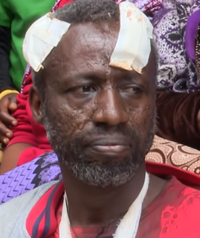
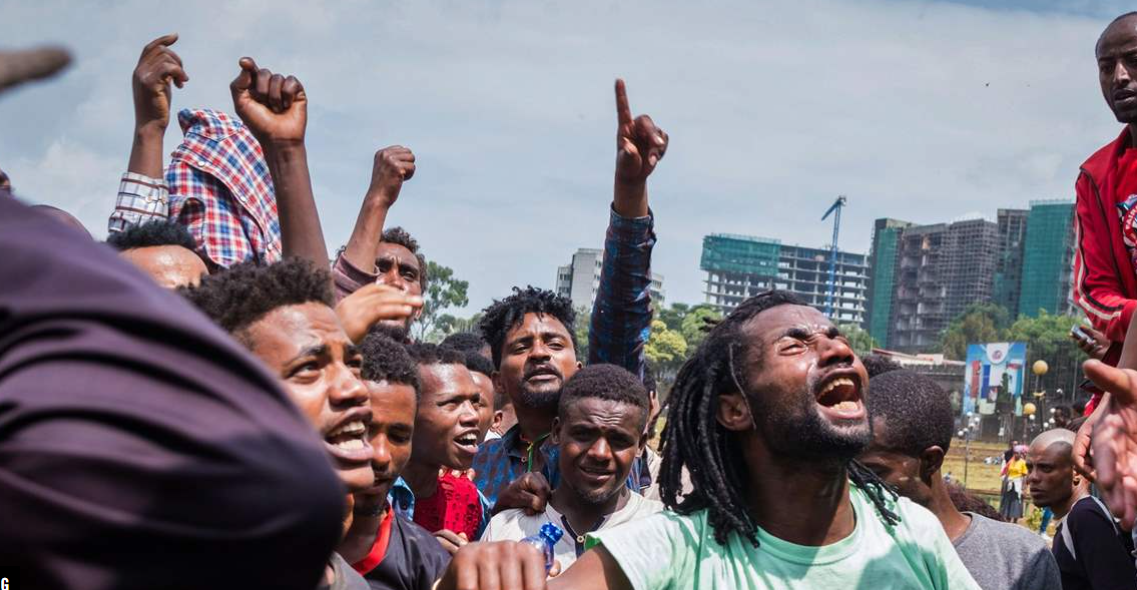
Ethiopian capital hit with deadly ethnic protest as a reminiscence of Rwandan type Genocide many died and wounded
Ethiopian capital hit with deadly ethnic protest as a reminiscence of 1994 Rwandan type Genocide in the suburb of the city, and many seen fleeing in desperation. An unknown numbers … Read More
Ethiopia’s corrupted, marred by scandal Blue Nile Mega Dam project stalled!
Africa’s largest mega of the Blue Nile has been full of scandal from its inception. The minority led TPLF authorities misappropriated over six billion Ethiopian birrs from the project. The dam is seen by majority Ethiopians … Read More